What is “Wenny Meadow”?
Wenny Meadow is an expanse of natural green space within the town. It is located between Cromwell Community College (on Wenny Road) and the A142 bypass. The meadow is the former Manor Park of Chatteris, and used to be attached to the Grade II Listed Manor House. It contains medieval ridge and furrow earthworks.
There is a planning application requesting permission to build 93 houses on the meadow. This is the first phase of a 350-house development. You can read more about that on the Development Context page.
I’ve heard it called something else!
The name “Wenny Meadow” was invented by local campaigners in 2017, who were looking for a way to describe what and where it was. It has been known by many names.
These names include:
- Wenny Meadow (adopted by campaigners)
- Wenny Fields (used by Chatteris Town Council)
- Manor Park (mostly historical)
- Manor Fields (a nod to the historical usage)
- Rickwood’s Field (a reference to the former owner, Arthur Rickwood)
Where is Wenny Meadow?
You can see the location of the area known as “Wenny Meadow” (and other names) bounded and shaded in green on the map below, or by viewing the map here.

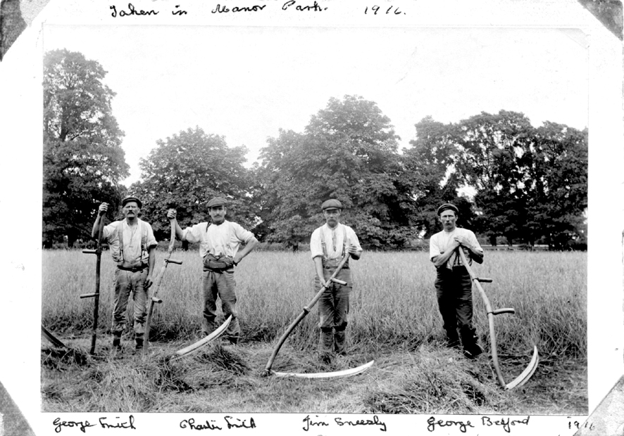
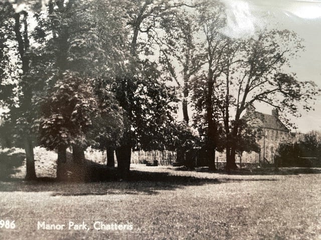
The former Manor Park
Wenny Meadow used to be the Manor Park, attached to the Grade II Listed Manor House (a private residence on Wenny Road). The Manor Park is shaded on this historic map. Some of the Northern end of the park has been built on, particularly around the icehouse. The Manor Park is in the Cambridgeshire Historic Environment Records with reference number CHER 12046.

There are also photographs of the Manor Park in the Chatteris Community Archive, and newspaper articles about events at the Manor Park in the British Newspaper Archives.
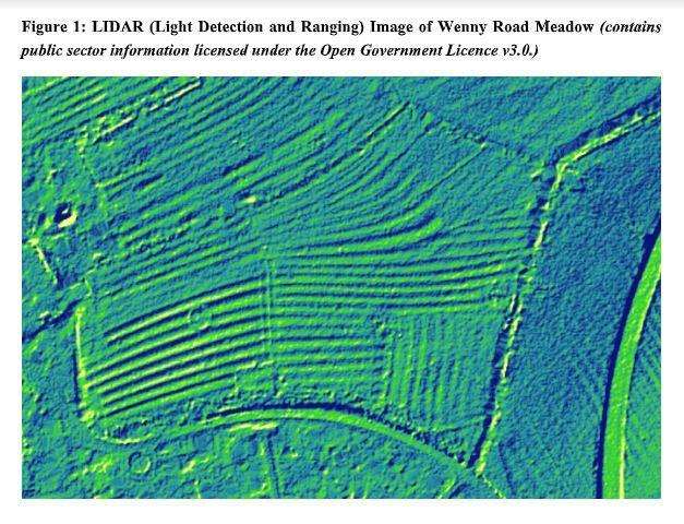
Medieval ridge and furrow earthworks
There are medieval ridge and furrow earthworks across the full extent of the meadow. These medieval farming features give the meadow an undulating landscape. The shape of these earthworks can be seen on the LIDAR imagery below.
Ownership of Wenny Meadow
The Meadow is privately owned. The East Chatteris Broad Concept Plan shows the ownership of the different parcels of land within the development area. Wenny Meadow is highlighted in blue.

Ecology and Biodiversity at Wenny Meadow
Ecology surveys undertaken at Wenny Meadow by Cannon Kirk’s appointed ecologists identified:
- ten species of protected bat;
- 31 species of bird (five on the “red list”);
- three species of reptile; and
- four “red list” invertebrates, including a type of pseudoscorpion only previously recorded in places like Sherwood Forest and Windsor Park.
The developer’s appointed ecologist says that Wenny Meadow is:
- of “district importance” for birds;
- of “county importance” for reptiles;
- of “county importance” for invertebrates (insects); and
- a “valuable foraging resource for bats”.
A plan to build 93 houses
A planning application to build 93 houses on Wenny Meadow was submitted in August 2021. The council has not yet decided whether or not to approve this application. The application includes the retention of about one-third of Wenny Meadow as public open space.
The following image shows Wenny Meadow, with the developer’s plans overlaid on top:

These homes are the first phase of a 350-house development. You can read more about this on the Development Context page and you can view the full plans on the Fenland District Council website.